DepthSpace3D
a digital tool for 3D Space Syntax analysis
 PORTRAIT

Universidade da Coruña Summer School
19th to 30th July 2021
Integrated into the International Summer School 2021 Course Programme at the Universidade da Coruña, DepthSpace3D is part of the course 'Formal Methods in Architecture and Urbanism: SCAVA (Space Configuration, Accessibility and Visibility Analysis)'
The course teachers are three researchers from the team that produced DepthSpace3D.
This summer course has three fundamental objectives:
to introduce formal methods in Architecture and Urbanism and, within this particular approach, SCAVA – its theories, concepts, and methods;
to provide students with knowledge of spatial syntax tools to describe the physical form of architecture/cities and explain their operation with a focus on the relationship between space and society, and on movement;
to provide students with tools to evaluate the impact of their proposals on the existing city, considering not only the immediate environment of these proposals, but also the city as a whole.
The course will articulate:
theoretical fundamentals of SCAVA;
presentation of several case-studies demonstrating the potential of SCAVA for in-depth analysis of spatial problems in architecture and aid the professional architect to produce better designs;
practical training in the use of several academic or commercial digital tools currently available.
Participants will be able to develop spatial analysis of projects in the areas of Architecture, Urban Planning and Landscape Architecture, informed by the theoretical formal methods of SCAVA, and using dedicated digital tools: DepthMapX, spatial analysis plugins for QGIS, DepthSpace3D and SCAVATools. These methodologies have proved to be useful both in the analysis of spatial problems and in architectural practice. They can help optimise solutions in:
security (CCTV placement, agent placement, children surveillance);
economy (value assignment to space, product placement, publicity);
traffic (accessibility, clutter, jams prediction);
aesthetics (monumentality, space diversity, remarkable places);
urbanism (skyline protection, centralities, equipment distribution);
social studies (social segregation, control, functional uses of space).
This know-how has a professional demand not only in the architectural office, but also in real-estate, large buildings’ management or public administration.
Although the techniques involved are wide-ranging, the course will be orientated to deal with architectural, urban and landscape space problems. Thus, the course will be more profitable for professionals and students in the areas such as:
Architecture;
Building Engineering;
Urban Planning;
Urban Engineering;
Landscape Architecture;
The course is dedicated to training in SCAVA computer applications.
As these have more or less strict connections with other more widespread applications, it is advisable that students have general knowledge about CAD and GIS tools.
English. The tutorial monitoring of each student by the monitors can also be held in French and Portuguese.
The workshop must have a maximum of 24 participants.
The participants are expected to:
bring their own laptops (OS Windows only);
have DepthMapX installed in the laptop;
have QGIS installed in the laptop;
have DepthSpace3D installed in the laptop;
have a 3D CAD software (Revit, ArchiCAD).
The course will have several types of sessions:
theoretical presentations;
workshops:
step-by-step instructions for using different digital tools, with small practical cases, with close proximity by two trainers;
a case-study (chosen by each participant) that they will explore to carry out a deep analysis of spatial problems and search for optimized solutions.
A. Introduction: Formal Methods in Architecture – a global approach.
B. SCAVA (Space Configuration, Accessibility and Visibility Analysis) methodologies – theories and case-studies.
C. Workshops
(if necessary, software installation can be done in the beginning of the workshops)
C.0. Global overview of SCAVA software applications
case-studies: the potential of the digital tools to solve architectural space problems;
features of the available software applications.
C.1. Workshop 1: DepthMapX and Space Syntax Plugin for QGIS
Creation and edition of the 2D geometries of the spaces considered for analysis – case-studies chosen by the participants.
For each of the four approaches:
'Isovist';
'Agent-based';
'Axial lines' and 'Segments';
'Convex Spaces'.
A set of processes will be produced with DepthMapX:
creation and edition of the particular model;
calculus of Space Syntax quantities;
display of the results, both in graphical and numerical forms;
interpretation of results.
It will be explored how DepthMapX articulates with GIS for the analysis of complex urban systems.
Using the Space Syntax Toolkit (Gil et al., 2015) for QGIS, participants will explore:
graph modelling through the manual drawing of axial lines or integration of existing road-centre-line maps;
graph analysis with different attributes and radii;
visualisation and interpretation of results.
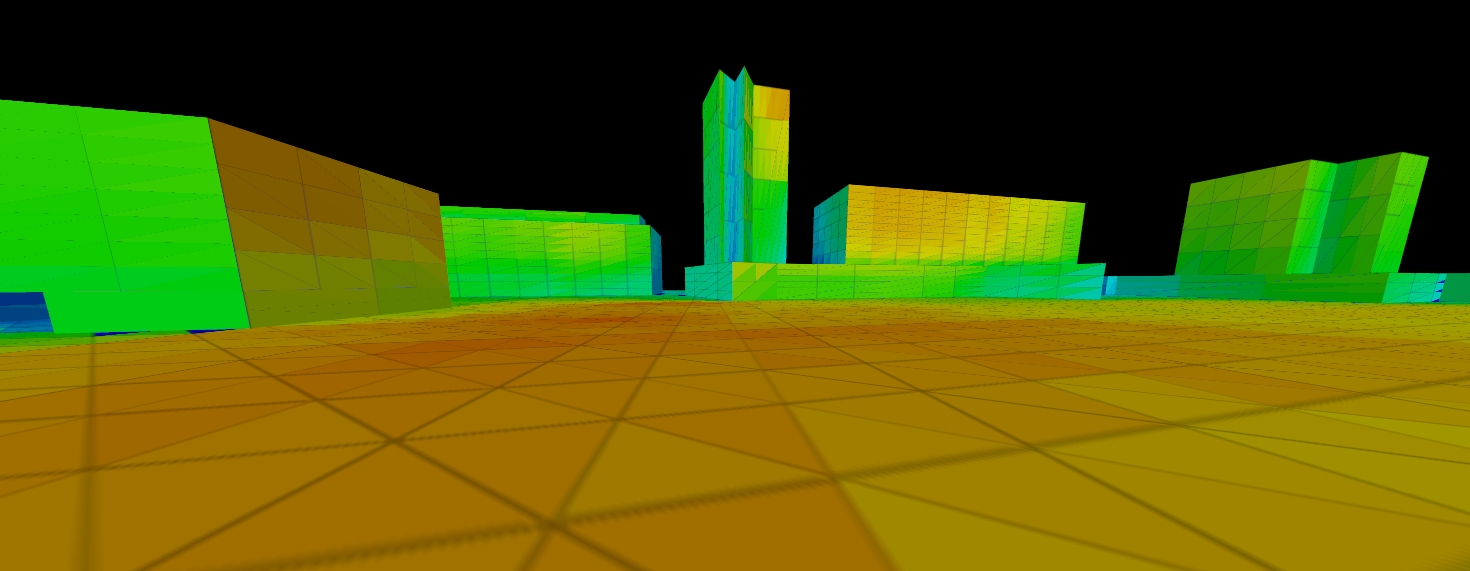
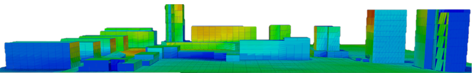
C.2. Workshop 2: DepthSpace3D
Brief introduction to the main differences between 2D and 3D analysis.
Operation with the digital tool, solving case-studies chosen by the participants.
Creation and edition of the 3D geometries of the spaces considered for analysis:
‘Viewing Space’ (with multiple Paths, with different visibility weights);
‘Viewed Space’ (two-sided Surfaces and Global Volume), also with different visibility weights, and with the possibility to introduce properties or attributes to different regions of the space;
‘Obstacle Space’, with different transparencies and opacities:
calculus of Space Syntax quantities;
display of the results, both graphical and numerical.
3D of the ‘Viewed Surfaces’;
3D of any slice of the ‘Viewed Global Space’;
2D of all the slices of the ‘Viewed Global Space’;
3D of the ‘View Points’;
interpretation of results;
Some examples in middle-level operations:
changing the user interface;
creating new items in the geometry generator library.
Brief introduction to advanced themes:
editing a generative grammar for the 'Space Syntaxes'. With this tool, the study is not limited to the standard concepts (depth, isovist, connectivity, etc.) as the generation of new concepts can be formalized;
accessing the open Data Base with all the data (inputs and results) of the analysed cases.
C.3. Workshop 3: SCAVATools
Global overview of SCAVATools:
global scheme;
architect's goals driven design;
LoD (level of detail) from the full CAD project;
interpreting the results.
Operation with the digital tools, solving case-studies chosen by the participants:
ALPHA - creation of the 3D Space model;
BETA, THETA - creation of the Active (Agents) Space;
IOTA, GAMMA, DELTA, EPSILON - reduction to condensed space models;
ZETA, ETA - Calculus of Space Syntax Quantities;
KAPPA - Display of the results, both graphical and numerical.